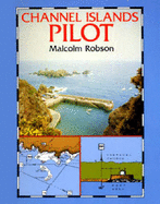
The Channel Islands have one of the most perilous coasts in the world. The author guides the navigator by using illustrated transit bearings that relate to large-scale charts. By this detailed system yachts are able to find small anchorages and passages that do not appear in more conventional pilots. This new edition has a revised format which makes sea-going reference more convenient. It covers Alderney, Guernsey, Jersey, Sark, Herm, Jethou, Les Ecrehou and the Minquiers and also includes advice on weather, tides and local ... Read More
The Channel Islands have one of the most perilous coasts in the world. The author guides the navigator by using illustrated transit bearings that relate to large-scale charts. By this detailed system yachts are able to find small anchorages and passages that do not appear in more conventional pilots. This new edition has a revised format which makes sea-going reference more convenient. It covers Alderney, Guernsey, Jersey, Sark, Herm, Jethou, Les Ecrehou and the Minquiers and also includes advice on weather, tides and local sailing conditions. Read Less